Irwin, ID
Saturday, July 16
Weather - hot and humid
After a restless sleep, I was up a few minutes before my alarm went off. Even though I had braided my hair the night before and laid everything out - things still took longer than I anticipated. I don't know why I don't allow for this, this seems to be a new trend for me, especially if I'm doing a trail race. Anyway. I tried to eat some leftover pizza but it just did not taste as good. (As an aside, not sure why I've been having so many issues eating early in the morning). The drive up was fine, although I had to use my brights - it's DARK out here!
I got to the start area about when I thought I would, even with leaving late. Used the bathroom right when I got there near the cabin I didn't end up staying at.
Took my pack (not sure why) and checked in at the lodge. Then I realized I still had a LOT of time until we started, so I went back to the car.
With about 10 minutes to go I headed back towards the start, mainly so I could use the bathroom again. I lined up where I always do - the VERY back. Woo! It was nice and cool at the start, and a beautiful sunrise. After the national anthem we started - right on time. Off we go!
Not that I ever run hills in a race setting, but I certainly wasn't going to right off the line, so I dug in my poles and did my thing, just plodding along. Within a tenth of a mile, we hit the first bottleneck when we arrived at the trail - which was VERY steep and VERY single track.
All I can say is - THANK GOD FOR POLES. I was dying immediately. I think I had to pull off the trail and take my first breathing break before I had even made it a quarter of a mile up. It was SO steep.
Before I knew it, I was literally THE VERY LAST PERSON on the climb. The race director had told us at the pre-race meeting that there were going to be sweeps in every distance, and I imagined I was going to become BFFs with them before long. Seriously, the climb had me gasping for air and 1). questioning why I was doing this again and 2). being seriously relieved I hadn't done something even dumber - like sign up for the 50 or 100 mile.
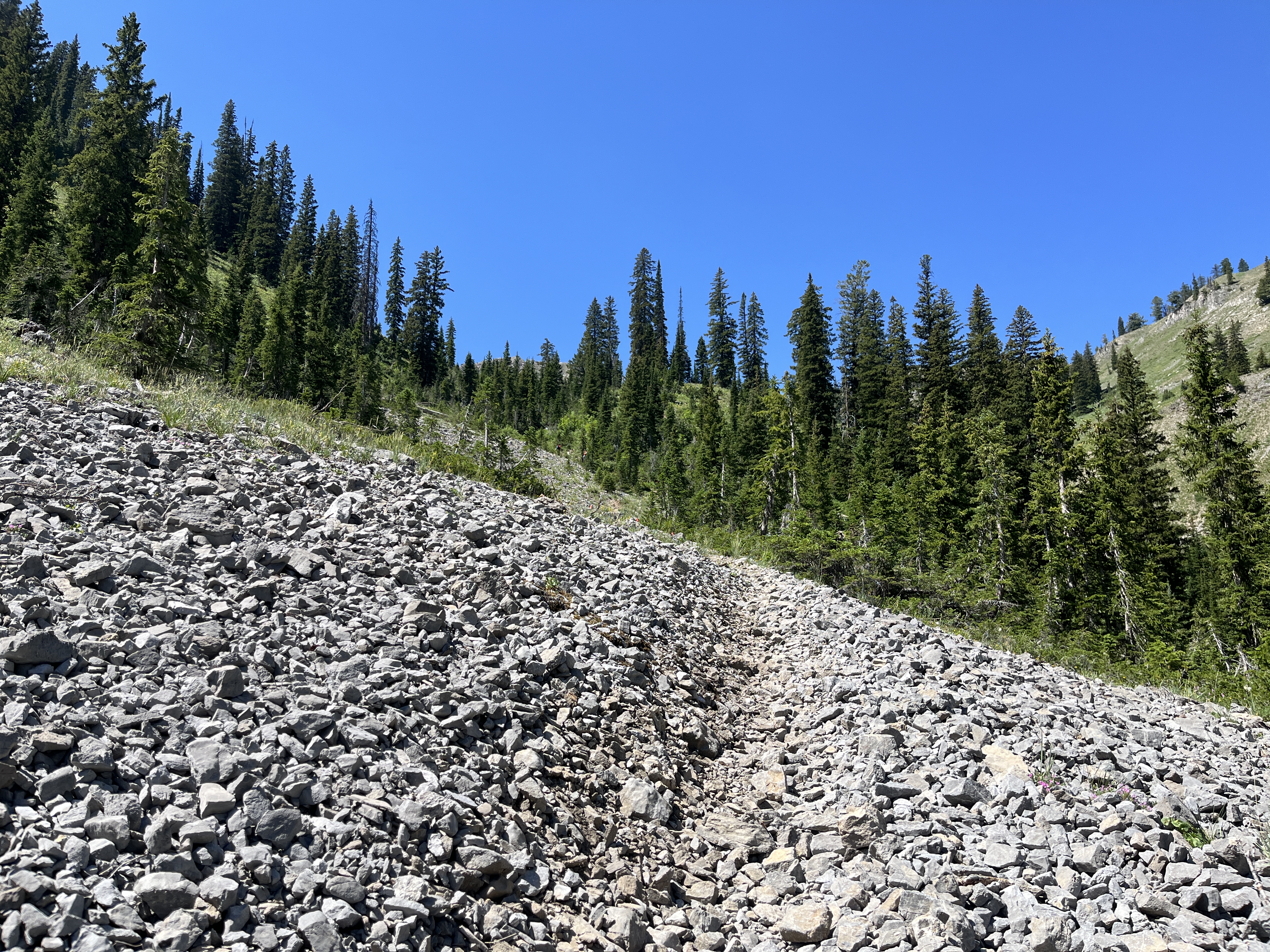
After looking at the data later I saw at least one section where the grade was over 40%. That's nuts. We had a small reprieve of some flats about a mile in, and that's when the wildflowers first came into view.
I was chatting with a gal from Idaho Springs on the climb, she seemed to be the only other person (besides one guy) that was having to stop and take breaks, but either way, it was nice to have someone to talk to. The climbing continued and we headed up a ridgeline and got a nice view of Big Elk lake below.
Pretty sure I took a bulk of my pictures in this section. I appreciated the breaks, plus it was just SO beautiful!
We suddenly came to a boulder field, and it was the one time that I briefly lost sight of where the trail was. I could see a flag in the distance, just not the best way to get there. Luckily the guy that we were with saw where the trail was, and then he took off. Before I knew it, we had arrived at what was called one of the "critical" turns on the course. I thought it was marked very well and I have no idea how you could possibly miss it.
We passed a gal and then came upon the guy that had just led us out of the boulder field sitting on a rock in the shade eating a snack. That reminded me that I should also eat something, so I pulled out some Honey Stinger chews. I opted to keep going and unfortunately the gal that I was with (wish I could remember her name) never caught back up with me. I now had three people behind me and was grinding up yet another steep climb.
Arrived at a plateau and there was a cute cabin at the top! We veered off to the left, and then we actually had some downhill. It was fairly technical and steep so I didn't run down as fast as I could have, I really needed to be sure I didn't fall and didn't want to roll an ankle.
Also came across the first of the water crossings! The water was not deep and the trail was still marked really well.
There was actually about a mile, maybe two, that was on a dirt road and I was able to run that pretty well. The first aid station was supposed to be around mile 9. We turned onto a "main" dirt road that was not closed to traffic, so that was my least favorite part with the ATVs and vehicles kicking up dust. Probably the best things on this section was it was not technical, and the cows. They had the funniest "moos" - they almost sounded like huskies! It was really cute.
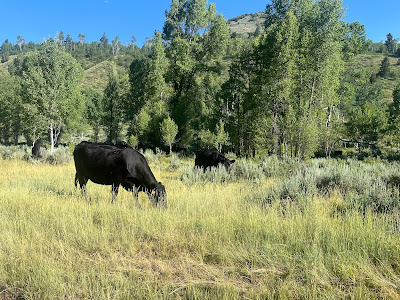
Arrived at the aid station. Finally. It had taken me something like 3:20 to go the 9ish miles. On my way into the aid station I got passed by a lady running the 50 miler - she looked fantastic! I was brief at the aid station. Watermelon, Dr. Pepper, filled up water for the next section, and a random pierogi. I think I also grabbed some pickles. There had been 5-6 people at the aid station screwing around, but I knew I was going to be fighting the clock all day so I got out relatively quick. I should have taken a picture of the trail head sign that warned about bears, but I didn't. The climb out was relatively mild to begin with. I got passed by the 50 miler again, but the other people from the aid station never caught up to me.

I saw a 100 mile runner coming towards me - and he looked MISERABLE. Even his pacer didn't look happy. Based on what I had seen of the course so far, I could relate. I was once again VERY relieved that I was doing the 50K. I actually don't really remember a lot from this section, but it was really pretty. It was getting hot out.
I passed a couple people in this section, including the husband of the gal that I had been running with at the start. I also passed a gal that already had the "lean" and looked really rough. I offered her salt and electrolytes, but she said she was ok.
I got to the Garden Gnome aid station and it was cute! The tables were really low to the ground (I'm assuming for gnomes?) Filled up my bladder and bottles since we were warned the next section was a BIG climb (like 2,600' or something) and it was supposed to be VERY hot and exposed. I grabbed some watermelon, pickles, and a bag of trail mix. Nothing sounded very good and I'm sure I didn't eat as much as I should have. One of the people I passed, an "old dude" got out of aid before me, so I had someone to try to catch. I realized I needed to pee and figured I should do it before we got out of the cover of the trees. Sure enough, before I knew it, the climb had started.
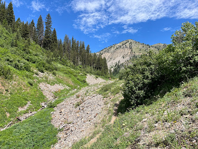 |
| You can see a speck of red on the trail - that's the older guy I'm still trying to catch |
It really was a beautiful section of trail, but it was just so hot. I'm glad I took a minute to look behind me - what a view!
About this point, maybe 15-16 miles in is when the "casualties' started. I began to catch up to people that were stopping and taking breaks on the side of the trail. The handful of small trees that were in this section were lifesavers from the oppressive heat.
I couldn't figure out where the trail was going, and came across a small field of scree. Ugh...
It became apparent to me that we were going to go up along the ridgeline that was across the valley. There was a guy struggling on the trails and I offered him salt, which he took. I think I probably passed at least 4-5 people on this section, which is saying a lot because it was a grueling climb and I was definitely struggling. I did have multiple people (all men), say that I was a great climber and I "looked great." Haha.
FINALLY, it seemed the end was near! I knew the course maxed out at 8,800 feet (ish) and that's what my watch said I was at.
Sure enough, the horrific climb was finally done. There was one turn to head down, which again, was VERY obvious to me.
I thought I would be relieved to be going down, but other than being able to breathe finally, it was NOT fun. It was very steep and pretty technical. It was either rocky or sandy, but to mix it up - sometimes both! I passed a guy in this section and he also told me I was looking pretty good. Yay!! It was hot even in the trees, but at least we had some protection from the sun. The course opened up a bit and we moved into a more open part of trail with very overgrown bushes and plants. I did get passed by a guy doing the 50 miler in this section, but I continued to stay ahead of everyone I had passed, and even passed another couple of people in this section.


I passed a gal and came across a bunch of horses. She thought we might be close to the aid station, but based on my mileage I thought we still had a ways to go. We arrived at the biggest water crossing and I nearly fell in, but grabbed the rope at the last minute. I was so appreciate of the water crossing and I got my hat wet again. (I'll edit to add the picture from the photographer when it's ready). We were actually at the aid station!? Already? Ok!! I wanted to be in and out of the aid station. The volunteer told me I'd be back in an hour and 10 minutes, and that it was only 5.2 miles round trip. I told him that was very sweet of him to think I could move that fast. I grabbed some Dr. Pepper and a pickle and headed out. The first half mile or so was pretty runnable - and I jogged what I could. It got a bit more technical for a bit, lots of rocks.


With this section being an out and back I could start to gauge if anyone was close enough for me to catch in front of me, and to see how far behind me people were that I had passed earlier.
I was pretty surprised when I got to the turnaround probably a half mile sooner than I thought I would. Gave the volunteer a fist bump and headed back. Lots of people still coming up the trail.
I was back at the aid station before I knew it, and only a few minutes slower than the volunteer had guessed I would be there. They told me it was only about 3.3 miles to the finish? WHAT??! I ran back to the river, dunked my hat and got the heck out of there. I was ready for this to be done. This section was actually pretty runnable, but man, my legs were TIRED from all the climbing, so I walked more than I would have liked.
I even managed to pass a couple girls probably a half mile from the finish. All of a sudden, I could hear the announcer at the finish line! Wooo, I was almost there! We had to run through the parking lot and then up the stairs to the lodge. I MANAGED TO NOT GET PASSED BY A SINGLE PERSON IN THE 50K DISTANCE. I am pretty sure that has never happened, ever.
Official Time - 10:06:00
Overall Place - 57/76
Gender Place - 24/33
Garmin time - 10:05:59
Garmin Pace - 20:44
Elevation gain - 6,989'
Miles 1-5 - 30:52, 35:46, 22:43, 23:53, 30:27
Miles 6-10 - 15:56, 14:14, 12:30, 13:54, 18:45
Miles 11-15 - 18:30, 18:31, 19:19, 25:20, 24:42
Miles 16-20 - 38:09, 29:15, 18:07, 18:22, 15:18
Miles 21-25 - 16:06, 19:10, 21:45, 18:17, 18:24
Miles 26-29.23 - 16:38, 16:50, 15:34, 15:25, 14:22 (pace)
(Other interesting stats - run time 2:35:26, walk/hike time 6:10:13, idle time 1:20:20 which seems high to me!)
I sat around at the finish for a bit. Drank a diet coke AND a Dr. Pepper. Had two otter pops. I was still SO HOT. Finally I got my post-race food of a brat, rice and veggies. It was delicious. I watched finishers come in for about an hour before I decided it was time to head out so I could get my beer.
Thoughts:
- I had this race on my radar for a long time. It hadn't worked out in the past because I've always had something else going on - and this year it was the same weekend as Vermont 100, which I obviously wasn't going to do anyway. I'm really glad I did this. After a DNF at both Antelope Canyon and Cocodona 250 I needed a "win" and a 50K distance always seems reasonable. I got my "win" but it was certainly a challenge!
- This course is pretty remote. There were a couple of times when I got a ping for a text message, but in general, there was no phone service at all. Only one of the aid stations was accessible by vehicle, the others people had to hike in. Those aid stations also had to filter river water for the aid stations! This also meant that there was NO ice at this race. That really sucked since it was so hot, but there were a decent number of water crossings where I could at least get my hat wet, and that helped a lot.
- Aid stations were pretty decently stocked, but again, with everything having to be hiked in, there wasn't a ton of variety. I had enough food on me to last the whole race, but appreciated the different items. Also, I think this was the first race I've ever had Dr. Pepper, which was fun.
- The shirt is a cotton blend shirt, light grey. Medal is the new fad of wood, which I like.

- I always am apprehensive when races don't have an address for the start line, but thanks to Google, I found it with no problems.
- This was HARD. The initial climb and the climb around halfway were both REALLY steep. I have been working on my climbing/hiking over the years and it was still really tough for me. I think the only reason I did better on the second climb is that I took it "easy" in the early miles AND I do "ok" in heat. It seemed a lot of people struggled more than I did with it, or maybe I just know how to deal with it better.
- Would I recommend? Sure, but know that it's going to be a loooong day. And if you go for a 50 mile plus you are seriously badass.
- Overall a very well executed event.